A report from a round trip, Bergen - Myrdal - Flåm - Bergen, by train and boat
The western part of Norway is known for it's steep mountains and deep
fjords. A lot of tourists, from all over the world, visit this area every
year.
In July 2004 we had some visitors from Belgium, a nice couple we have known for many
years. They wanted to see some mountains and fjords, so we thought that a
trip to Bergen would be nice, including this one day round trip from Bergen to
Bergen. The route is train from Bergen to Myrdal, swap train to go with Flåmsbana
from Myrdal to Flåm, and finally a boat trip from Flåm to Bergen.
The presentation is split into three parts:
Leg 1, train Bergen - Myrdal
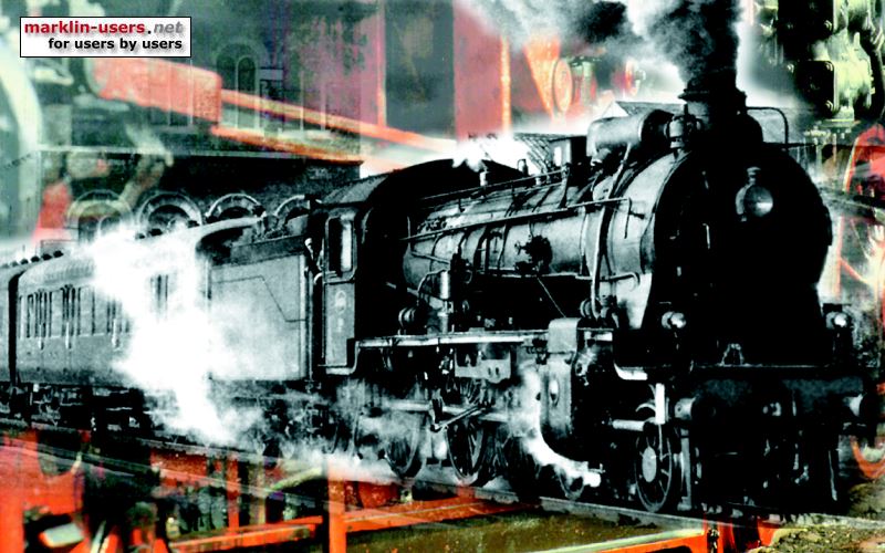
This is a part of Bergensbanen, the Oslo-Bergen railway line.
Leg 2, train Myrdal - Flåm
This is the famous Flåmsbana,
which transports more than half a million people every year, mostly tourists.
Flåmsbana is the third steepest adhesion railway in the world.
The photos in this presentation are made by some good friends, my son and myself.
Photos made by others than me are marked with names. Some photos are shot
from the train, some photos are shot from the scenic narrow road from Myrdal to
Flåm. The upper part of this road is only for walking or bicycling.
The panorama photo of Myrdal and the surrounding area is made by Mr. Svein Ulvund,
with his permission. Thank you.
The unmarked photos shot from the train was made July 9th 2004. The unmarked
photos along the track was shot in June and July 2009.
Myrdal is 866 meters above sea level, and the track climbs down to Myrdal,
altitude 2 meters, in just 20,2 km. Almost 80% of the line has a
gradient of 5,5%, or 1:18. The number of passengers have increased year by
year. Almost 600.000
passengers has travelled with this train annually the last couple of years.
First a panoramic view of Myrdal station and the upper part of the Flåm valley,
made by Mr. Svein Ulvund. A fantastic photo.
The lake to the left is Reinungavatn, supplying water to hydro power plant that
feeds Flåmsbana with electric power. The waterfall is Kjosfossen.
The power plant is below Kjosfossen, not visible in the photo. The zig-zag
road is a steep and narrow road (for walking and bicycling) going down to Flåm.
Inside the mountain, in Vatnahalsen tunnel, above the white "line" to the right of Kjosfossen,
the track describes a horseshoe curve, to help the descent down the
valley. Above the left part of the long white avalange protection, in a small
triangle shaped shadow,
it is a small opening in the mountain side, so the train passengers see the fantastic view of the valley.
Also the long avalange protection is open for a nice view down the valley.

The descent to Flåm starts at Myrdal station

Many nice places for a short rest if you use the road. It looks like young Mr. Simen Klatran
enjoys the rest, or maybe he is dreaming about a nice lunch? In the background is a part of the avalange protection over
the railway line, not far from Myrdal station.

Some old "buildings" can be seen from the narrow road. The
railway can be seen in the background.

An old bridge crossing the river. Maybe not so safe? The sign states
that the bridge has been overloaded by bicycle tourists.

Not so far from Myrdal station. Note the steel net in the mountain
side, to prevent rocks from falling down on the below track.

Nice scenery

Next to Reinungavatn, the track makes a horseshoe turn, From Vatnahalsen station down to
Reinunga station, the small yellow building in the center of the picture.

This photo was shot close to Reinunga station, in the opposite direction of
the above photo. The train soon enters the Vatnahalsen horseshoe tunnel.

A view through the mountain wall.

Another view, from the narrow road, almost the same location as above

The same mountain side, at Kårdal, seen from the narrow road winding down the hill side.
This mountain side is called Pinnalia.

Next is Kjosfossen station, where the train stops in the tourist season, and the
passengers can leave the train to admire the fantastic Kjosfossen water fall.

A big platform is built next to the track. The conductor is probably the
most famous in Norway. The signs in the background means 5,5 percent
inclination and 130 meters curve radius.

People looking at Kjosfossen waterfall.

Huldra
appears. Normally, if you meet her and talk to her, you're lost, or become
very lucky. This show, with song and music, that takes place almost every time the
train stops.

Kjosfossen station was built because of the power plant. No roads, and
nobody is living here.
Kjosfossen power plant.

The narrow road winding down the valley is very popular for bicyclists and
for walking trips.

The bicycle ride is quite exiting. You certainly need good brakes.
Some people claim to have worn out a set of brake pads on the way down. This
sporty lady is my colleague Ms. Hanne Klatran.

A view up the valley from further down. Sorry about the reflexes from the
train window.

This is also a view up the valley

Another shot down the valley, I think we are approaching Blomheller station.

The opposite view from Blomheller station. This is quite typical for
Flåmsbana, with the curves, steep hill and tunnels.

Just above Blomheller station the road stops, next to the tunnel opening in
the above photo. Only pedestrians and
cyclists are allowed.

Down the valley, between Blomheller and Berekvam. Berekvam station can
be seen far away, to the right of the picture center.

The track and the road before entering Reppa tunnel, with the new gates at the road
crossing.

At Berekvam
station, where the upwards and the downwards train meet. This is the
upwards train shot from the downwards train. Normally there are only one
locomotive in each end of the train.

Berekvam station with the two trains.

When stopping at Berekvam Station you can see this house. Several
identical houses like this were put up along the train lines in Norway, to house
the "line managers". It was split in the middle with two identical
inverted halves.

From the train, above Høga road bridge, looking down the valley, just before entering Høga tunnel.

The upwards going train approaches Høga tunnel,

exits Høga tunnel and soon passing the Høga road crossing...

...and going up towards Timberheller tunnel

From the train, approx from where it is in the above picture, just before
entering Timberheller tunnel

Up the valley from Høga, next to the road crossing. Timberheller tunnel
to the right.

The river from Reinungavatn and Kjosfossen follows the Flåm valley down to
the fjord. Some places there are some rather deep ponds. The water
looks very cold.

Four artificial tunnels were made by the railway constructers, to lead the
water away from the track bed. This one is next to Høga road crossing.

The other end of the tunnel leads the water under Høga road bridge.

Down the valley from Høga tunnel.

Several waterfalls can be seen from the train. I think this is 140 meters
high.

Further down the valley. The old Flåm village.

The train is soon arriving in Flåm, This is between Håreina and Lunden.

From behind.

Entering Flåm station, track 4

At the new platform.

At the old platform. To handle the increasing number of passengers, track 5
was removed and the platform was widened.

The train is soon empty

The conductor is checking that everything is in order before climbing up the
hills again

Flåmsbana has it's own museum
in Flåm, and while waiting for the boat to take us to Bergen, the museum was worth a visit.
A collection of the old locomotives used on Flåmsbana. This is a photo of
a picture hanging on the wall in the museum.

This locomotive has got it's own house now, as an extension of the museum, so it's not
outdoors anymore

Some other kinds of transport used on Flåmsbana, not allowed anymore.
Quite hazardous to run down the steep hills with these.

About Flåmsbana, source Flåmsbana's website:
| Flåmsbana |
 |
| Length |
20,20 km |
| Altitude difference |
864 m |
| Upper station |
Altitude 866 metres |
| Lower station |
Altitude 2 metres |
| Steepest gradient |
55 ‰ - 1:18 |
| Stretch steeper than 28 ‰ |
16 km - 79,3 % |
| Minimum curve radius |
130 m |
| Track width/gauge |
1.435 mm |
| Voltage |
15.000 V - 16 2/3 Hz |
| Maximum speed |
40 km/h |
| Duration of journey |
Approx. 60 min. |
| Brake systems |
5 |
| Tunnels |
20, total 5.962 m |
| Bridges |
1 |
| Water tunnels |
4 |
| Stops/halts |
8 |
| Stations |
| Station |
Altitude |
Kilometres from |
| Myrdal |
Flåm |
| Myrdal |
866 m |
0,00 |
20,20 |
| Vatnahalsen |
811 m |
1,13 |
19,07 |
| Reinunga |
767 m |
2,20 |
18,00 |
| Kjosfoss |
670 m |
4,40 |
15,80 |
| Kårdal * |
557 m |
6,34 |
13,86 |
| Blomheller |
458 m |
8,40 |
11,80 |
| Berekvam |
345 m |
10,51 |
9,69 |
| Dalsbotn |
200 m |
13,90 |
6,30 |
| Håreina |
48 m |
17,21 |
2,99 |
| Lunden |
16 m |
18,60 |
1,60 |
| Flåm |
2 m |
20,20 |
0,00 |
| Tunnels |
| Tunnel |
Length |
Built |
| Toppen, upper |
101,4 m |
1926-29 |
| Toppen, lower |
79,9 m |
1925-26 |
Vatnahalsen upper + lower
(horseshoe) |
888,6 m |
1924-34 |
| Pel 1692 |
14,0 m |
? |
| Pel 1667 |
22,7 m |
? |
| Bakli |
195,1 m |
1924-34 |
| Kjosfoss |
478,4 m |
1924-35 |
| Nåli |
1341,5 m |
1924-35 |
| Blomheller |
1029,6 m |
1924-35 |
| Melhus |
177,5 m |
? |
| Melhusgjelet |
11,1 m |
? |
| Reppa |
123,9 m |
1926-28 |
| Sjølskott |
39,2 m |
1931-35 |
| Geithus |
139,2 m |
1934-35 |
| Timberheller |
172,6 m |
1932-33 |
| Høga |
59,2 m |
1927-28 |
| Dalsbotn, upper |
154,3 m |
1925-28 |
| Dalsbotn, lower |
206,6 m |
1930-35 |
| Spælemyren |
24,6 m |
1929-30 |
| Furuberget |
424,0 m |
1926-34 |
* The trains do not stop at Kårdal
Leg 3, Flåm - Bergen
Out Sognefjorden and south to Bergen with a high speed boat
Thanks for the photos:
Svein Ulvund, Norway
Nicky Cremers, Belgium
Bjørn Wigholm, Switzerland
Hanne Klatran, Norway
Tom A. Sæbø, Norway
Some good links from NRK, the Norwegian broadcasting Corporation:
Flaamsbana minute-by minute, a link to the TV program about Flåmsbana
Download the front camera files, in 2D or 3D (I do not know if this works
abroad)
Updated
09.04.2013
Home